Buying a home is one of the biggest investments most people will ever make.
Yet many homeowners aren’t completely sure where their property actually begins and ends.
You may think you know your boundaries, but assumptions can quickly lead to disagreements when installing fences, planting trees, building sheds, or making other improvements.
Fortunately, there are several ways to identify your property’s boundaries—and one of the most useful clues may already be buried in your yard.
Why Property Lines Matter
Understanding your property boundaries isn’t just about curiosity.
Accurate property lines are important for:
- Building fences
- Installing driveways
- Adding sheds or garages
- Landscaping projects
- Resolving neighbor disputes
- Meeting local zoning requirements
- Protecting property value
A simple mistake regarding property boundaries can sometimes lead to expensive legal and construction problems.
That’s why it’s worth knowing exactly where your land begins and ends.
Start With Your Property Deed
The first place to look is your property’s deed.
This document contains a legal description of your land and often includes important information about boundary measurements and reference points.
Depending on your area, the description may use:
Metes and Bounds
This method describes boundaries using distances, directions, and landmarks.
Lot and Block
Common in residential subdivisions, this system identifies a specific lot number within a recorded neighborhood plan.
While legal descriptions can be difficult for non-professionals to interpret, they provide valuable clues about your property’s dimensions.
Locate Your Property Survey
A property survey is often the most useful document available.
Prepared by a licensed surveyor, it provides a detailed map showing:
- Property boundaries
- Corner markers
- Structures
- Easements
- Driveways
- Utility locations
If you don’t have a survey, your county records office, local assessor, or title company may have one on file.
The survey can serve as your roadmap when locating boundary markers on the ground.
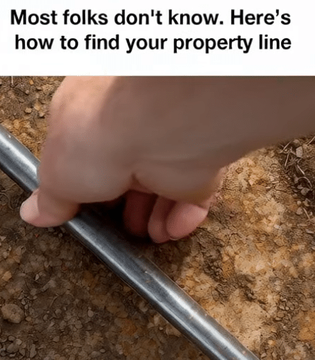
The Secret Hidden Underground: Iron Stakes
Many property owners are surprised to learn that surveyors often place metal stakes at property corners.
These markers are commonly known as:
- Iron stakes
- Survey pins
- Property markers
- Corner monuments
They are typically installed when land is surveyed and divided.
Although they may no longer be visible, they often remain buried just beneath the surface.
How to Find Property Stakes
One of the easiest ways to locate buried iron markers is with a metal detector.
Step 1: Review the Survey
Use the measurements shown on your property survey to identify the approximate location of each corner.
Step 2: Use a Metal Detector
Carefully sweep the area where the marker should be located.
Metal detectors can often identify buried survey pins even when they’re hidden beneath grass or soil.
Step 3: Dig Carefully
If you receive a signal, gently remove the soil around the area.
Many survey stakes are only a few inches below the surface.
However, older markers may be buried deeper due to landscaping or natural ground changes over time.
What If You Can’t Find the Stakes?
Not every property still has visible or intact markers.
Some may have:
- Corroded over time
- Been removed accidentally
- Been covered by construction
- Never been installed on older properties
If you cannot locate the markers, professional assistance may be necessary.
Can GPS Apps Help?
Modern technology can provide a useful starting point.
Several property mapping applications offer approximate boundary information, including:
- LandGlide
- Regrid
- OnX Hunt
Many counties also provide public GIS (Geographic Information System) maps online.
These tools can help identify general property boundaries.
However, GPS-based property maps are not always accurate enough for construction or legal purposes.
They should be viewed as helpful references rather than final proof of ownership boundaries.
Marking Your Property Lines
After locating the corner markers, many homeowners choose to temporarily mark their boundaries using:
- Survey flags
- Wooden stakes
- String lines
- Landscape markers
This can be particularly useful when planning outdoor projects or discussing boundaries with contractors.
When to Hire a Professional Surveyor
Sometimes the safest option is hiring a licensed surveyor.
Professional surveys may be especially important when:
- Building fences
- Constructing additions
- Resolving neighbor disputes
- Purchasing large parcels of land
- Selling property
A surveyor can verify boundaries, replace missing markers, and provide legally recognized documentation.
A Small Effort That Can Prevent Big Problems
Many property disputes begin with simple misunderstandings about where boundaries actually lie.
Taking the time to locate property markers and understand your survey can prevent future headaches, save money, and protect your investment.
The next time you’re planning a fence, garden, shed, or driveway, don’t rely on guesswork.
The answer may already be hidden underground, waiting to be found.